|
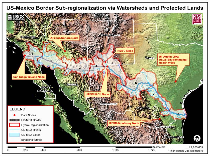
The datasets available at this website are all related to water resources along the lower Rio Grande region. They include groundwater, surface water, human population influence or infrastructure, and related ecological impacts. Some datasets cover the entire project area while others only include Mexico or the United States. Refer to the map to the right to see the project area and click on "Mexico", "United States", or "Project Area" to see data for that region. |

|
Questions or Comments? Please Contact Us. |