Downloadable Geodatabases
The geodatabase files are provided in a zip format. Included are the old and updated versions. The old version contains most of the vector data layers of the GIS project and the updated version contains most of the vector and all of the raster datasets. If your firewall software is set to block downloads of zip files you must first temporarily turn off the firewall or add this site to your trusted sites. Right click on the file name below to initiate the download.
PDNWC_Access_GDB.zip (initial version - 11/17/2006)
PDNWC_Access_GDB.zip (updated version - 06/29/2007)
NOTE: Geodatabases do not contain the JMAS Wells or EPCWID1 data, which can be downloaded as seperate shapefiles.
Data and Metadata
| Name | Download | Description |
| Organizational Data | ||
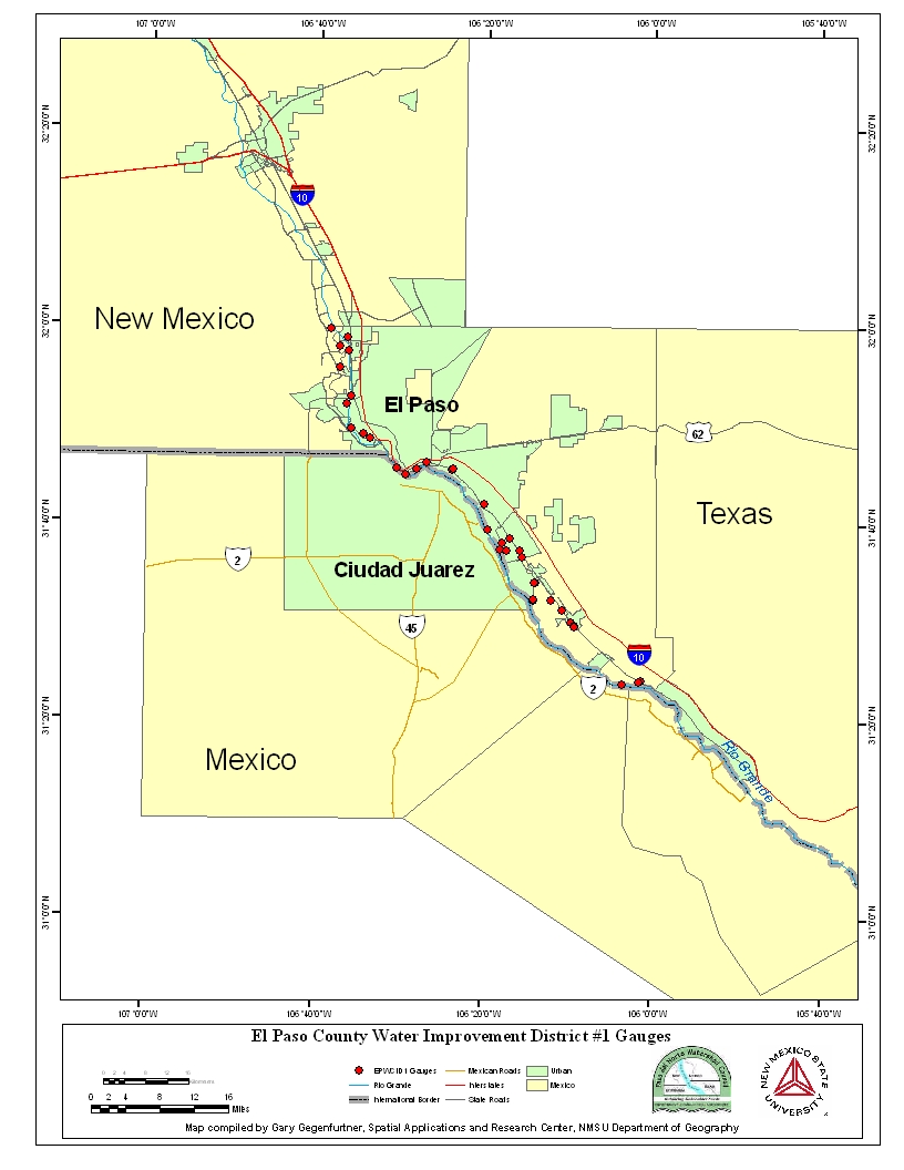
| El Paso County Water Improvement District #1 | The El Paso County Water Improvement
District #1 has provided point data of gage station locations enclosed
in the study region. Image |
|
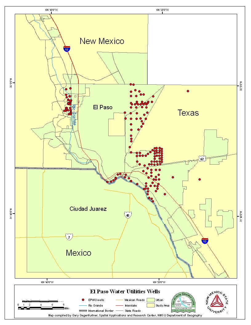
| El Paso Water Utilities | This dataset contains well point locations.
Also, included is information about each well or point, such as total
well depth, elevation, latitude and longitude, and the date the well was
drilled. Image |
|
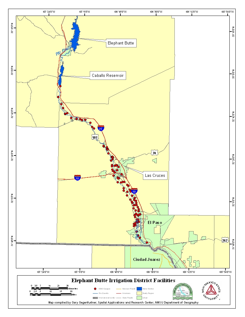
| Elephant Butte Irrigation District | Elephant Butte Irrigation District
provides data on gage stations that lie on the irrigation system, monitored
and controlled by this district. The names, counties, and states are also
included in this dataset. Image |
|
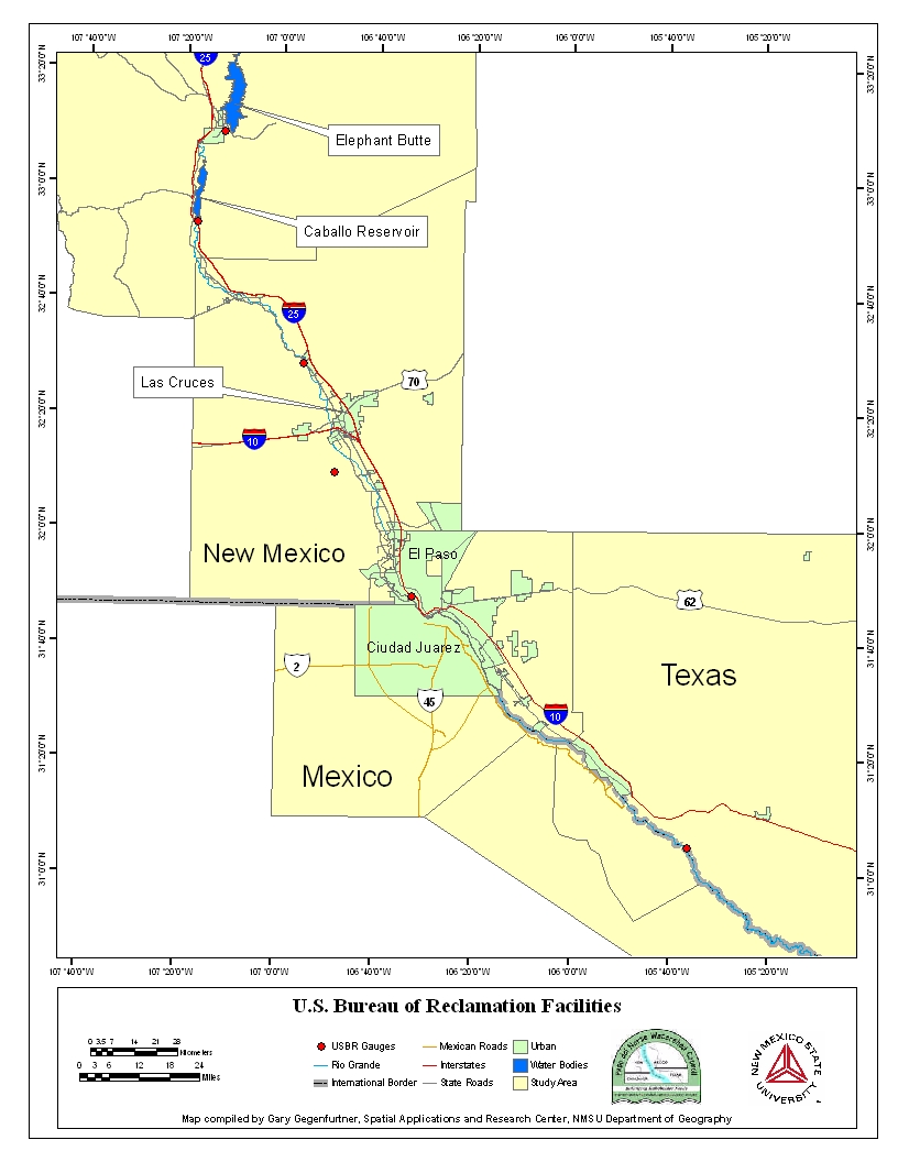
| US Bureau of Reclamation | The United States Bureau of Reclamation
monitors six control points throughout four counties. This data contains
the locations and names for these points.
Image |
|
| JMAS Wells | This shapefile contains data about
the locations of wells in the city of Juárez, Chihuahua drilled and maintained
by La Junta Municipal de Agua y Seneamiendo de Ciudad Juarez. Image |
|
| CNA Valley | This shapefile contains well location
data of the area for wells drilled and maintained by La Comision Nacional
del Agua in Mexico. Image |
|
| International Boundary and Water Commission | The IBWC covers the southern portion
of the PDNWC study region. The shapefile contains the point locations
of gage stations that are used to monitor water quality and stream flow
conditions of the Rio Grande. Image |
|
| USGS Data | ||
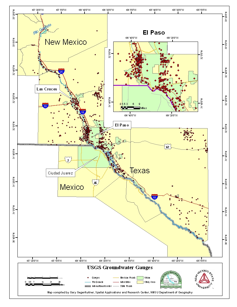
| USGS Ground Water | The point locations
provided in this dataset reference groundwater measurements of the study
region. Image |
|
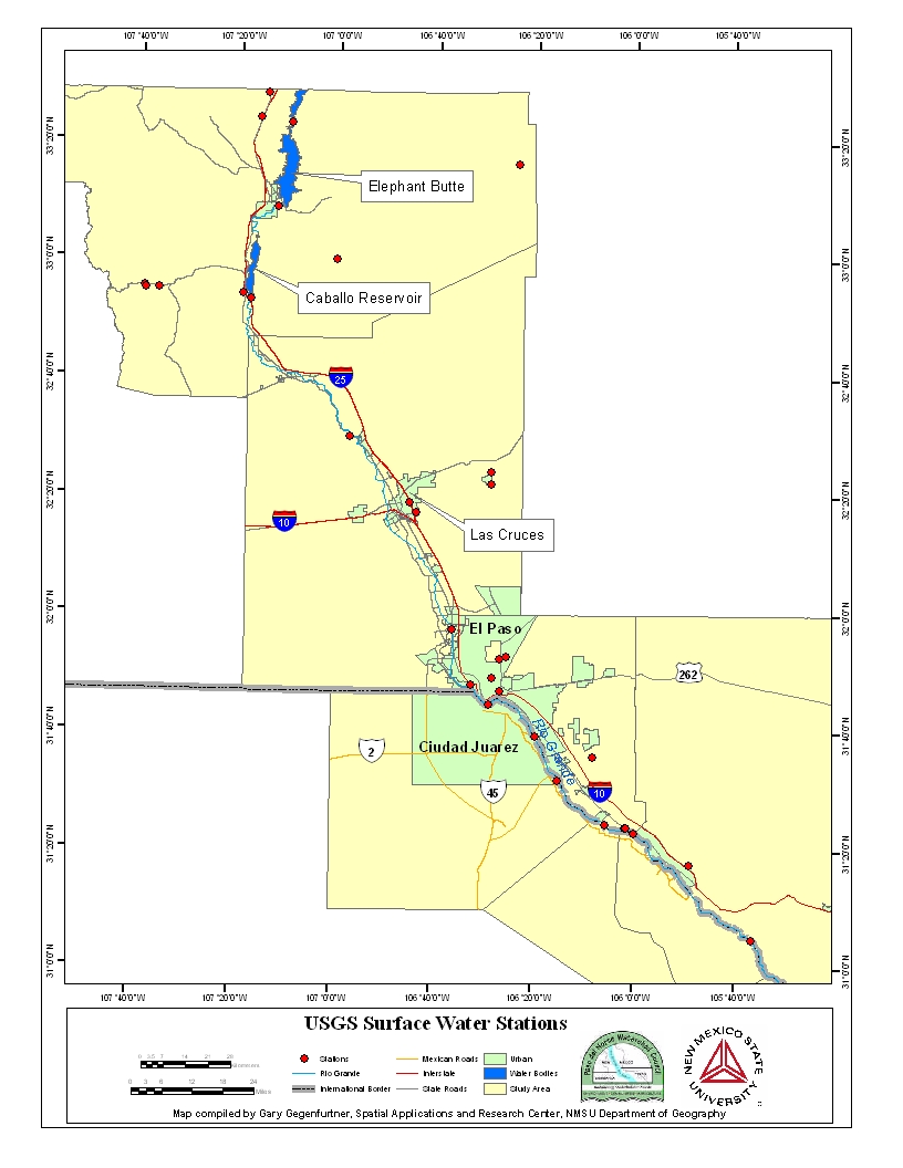
| USGS Surface Water | This shapefile provides data on flow
point locations in which reference flow and water quality of surface water
throughout the PDNWC Project area. Image |
|
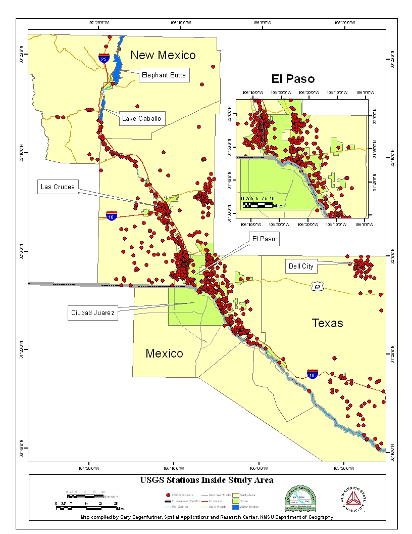
| Stations | This dataset contains all gage/well
locations controlled and monitored by the United States Geological Survey.
Image |
|
| Supporting GIS Data Layers | ||
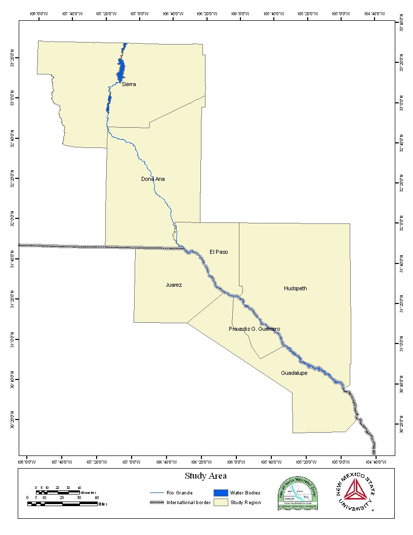
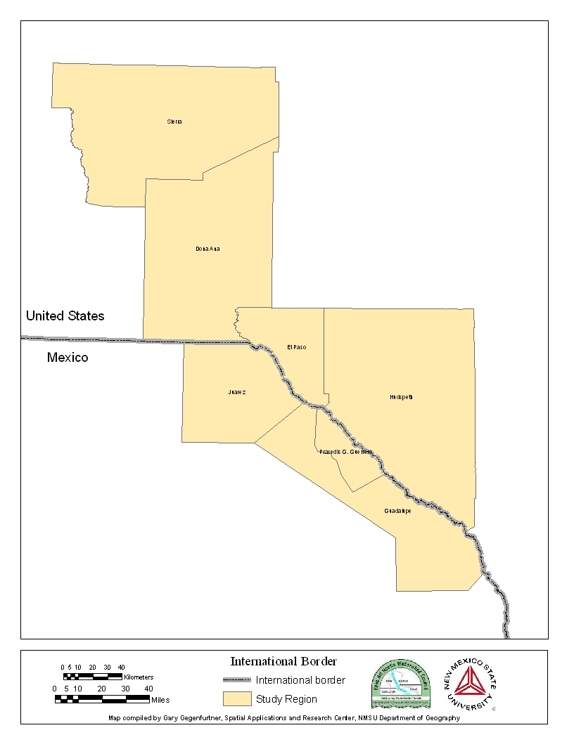
| Study Region | The study region shapefile provides
a boundary for the PDNWC Project area. Image |
|
| International Border | This data file contains an Arc shapefile
for the boundary between the U.S. and Mexico for the extent of the study
region. Image |
|
| Rio Grande | This is the river shapefile that maps
out the Rio Grande for the portion of the study region. It is not the
complete Rio Grande river system. It is clipped to the extent of the study
region. Image |
|
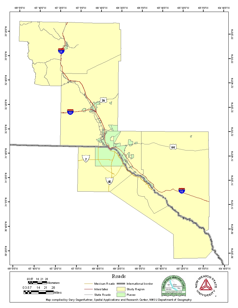
| US and Mexico Roads | The roads shapefile contains road
structures of both the United States and Mexico to the extent of the project
area. Only the major highways are included and it does not contain city
road structures. Image |
|
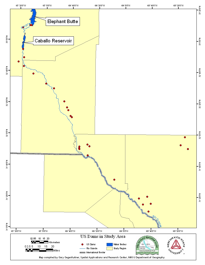
| Dams | This dataset contains the location
of dams in the United States along the Rio Grande. Image |
|
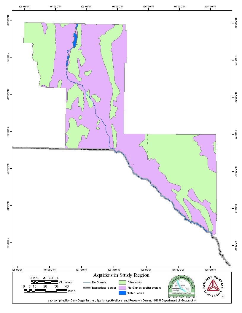
| Aquifers | This shapefile contains data on the
United States aquifer system for the project area. The attributes also
includes the aquifer name and the rock types associated with each aquifer.
Image |
|
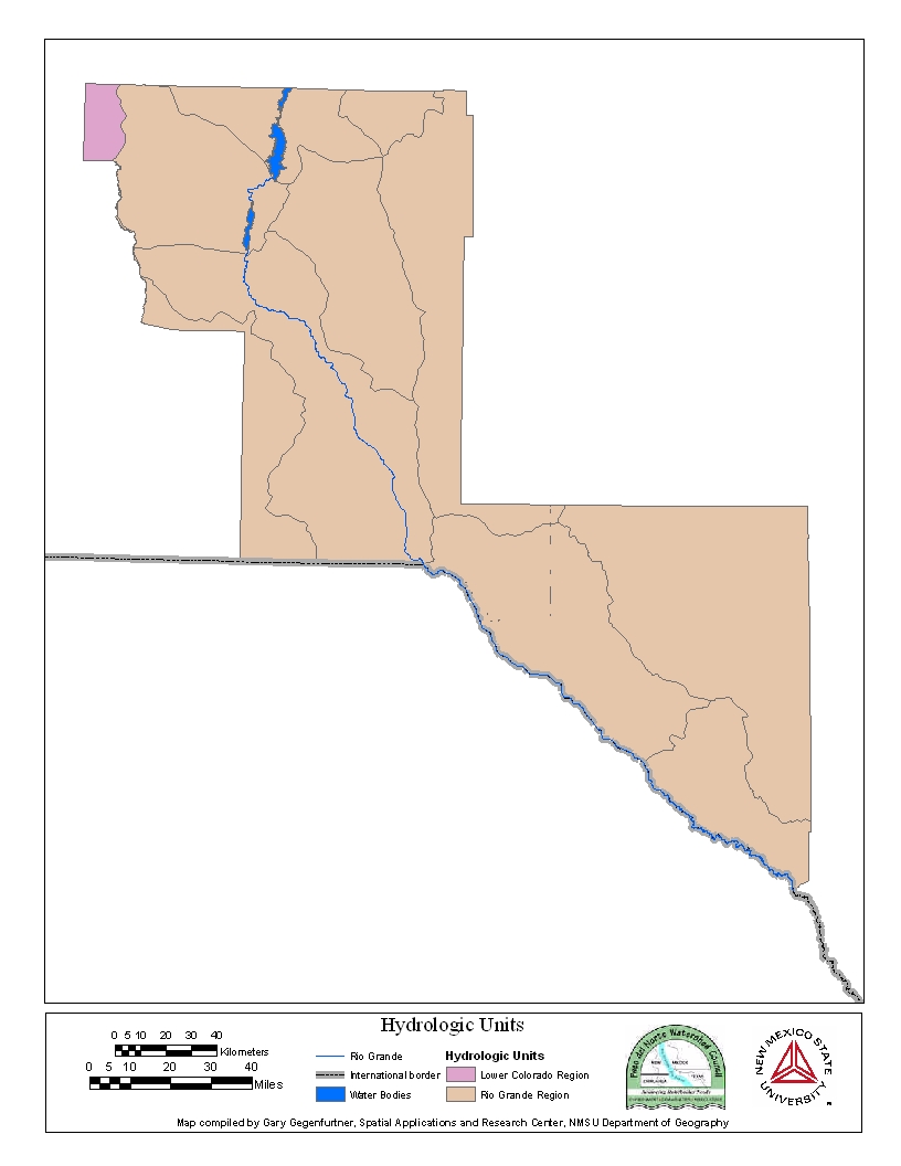
| Hydrologic Units | This dataset consists of polygons
that represent the United States hydrological units to the extent of the
PDNWC Project region. Image |
|
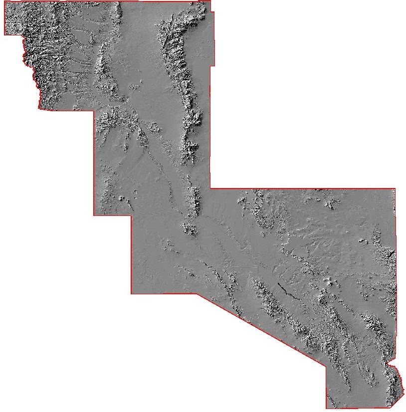
| Hillshade | This is an image that shows the Hillshade
of the landscape for the area of the project region. Image |
|
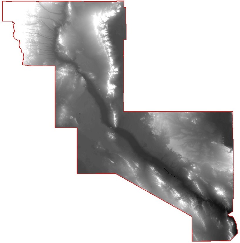
| DEM | ||
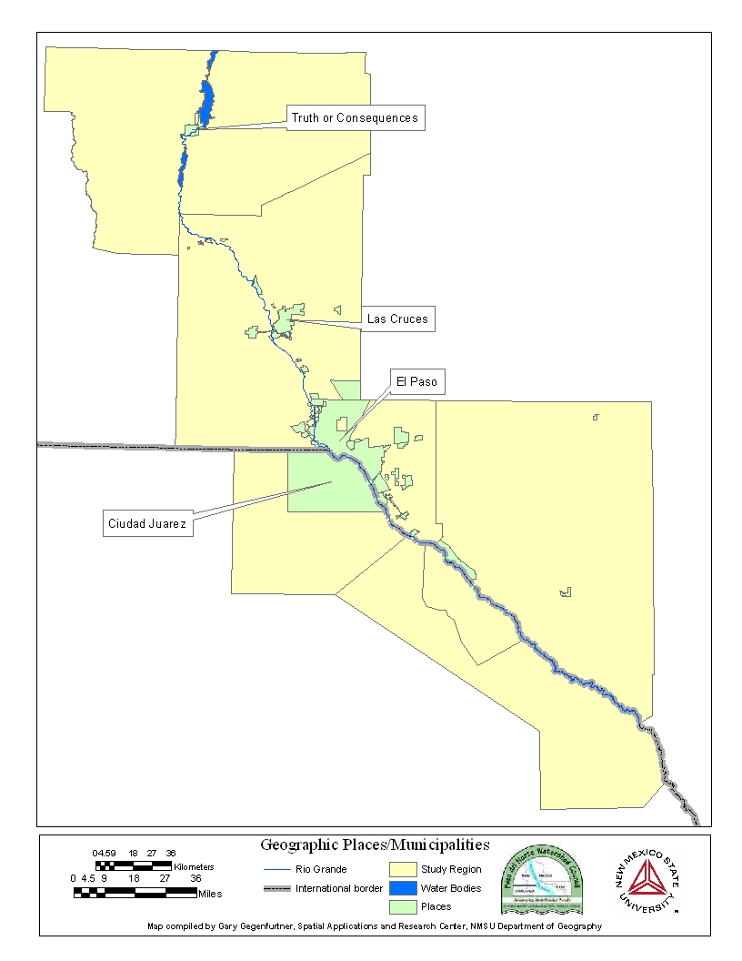
| Places | The places shapefile contains the
locations and area of cities within the study region. Image |
|
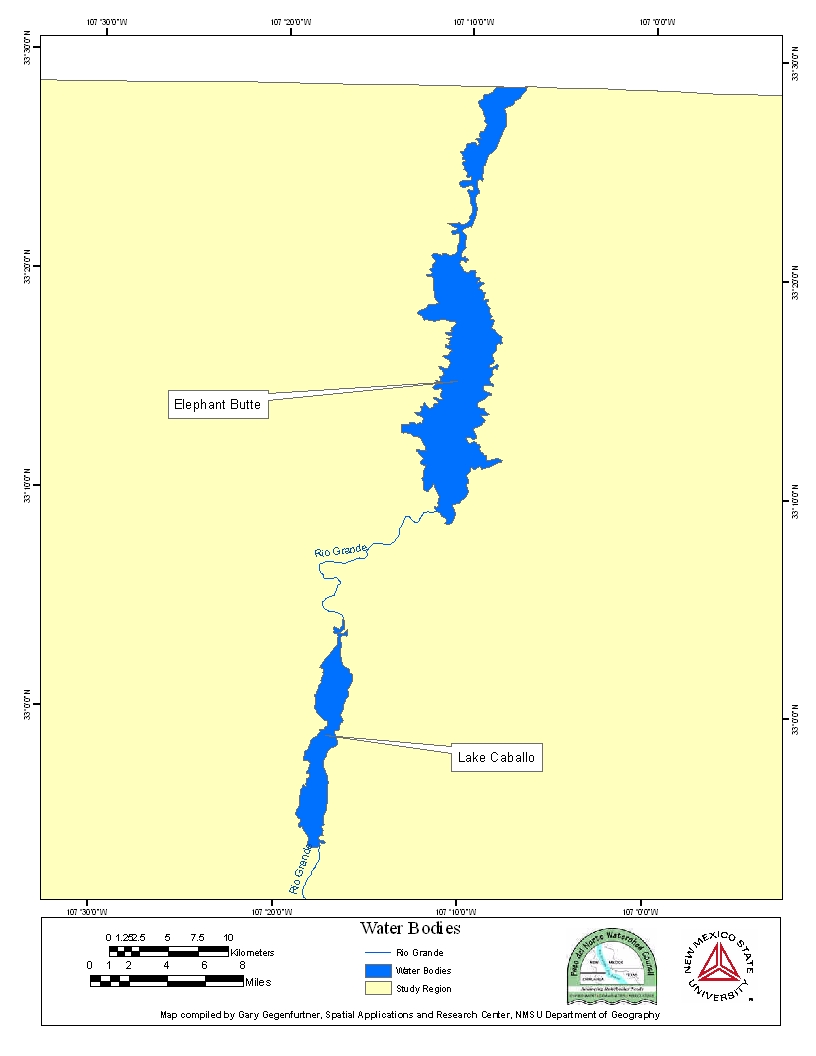
| NHD Water Bodies | This shapefile contains a polygon
file of the location of major NHD water bodies within the project area. Image |
|
| Riperian and Associated Data (USGS) | ||
| Mexico Riparian and Vegetation | MX Riparian | Zipped folder contains numerous shapefiles and raster data associated with riparian, landuse, and vegetation data within the Mexico portion of the study region. |
| U.S. Riparian and Vegetation | US Riparian | Zipped folder contains numerous shapefiles and raster data associated with riparian, landuse, and vegetation data within the U.S. portion of the study region. This also includes a .mxd file that in which data sources can be set in the "readme" file. | Riverware Model |
| Rincon Model | Riverware File | Zipped Folder contains riverware model along with Rincon Model Data tables. |