Introduction: Why do we Model?Every community depends on water for its health and continuity. The need for water goes beyond showers and what comes out of your tap. Industry, agriculture and business all have huge demands for water. Without enough water our society stops functioning, so predicting the amount, location and quality of water is absolutely essential. The way we predict these is by using models. A model is a mathematical representation of reality; the more accurate we can make them the more we know about our water resources, and the better we can preserve and manage them. |
The Hydrologic cycle: Types of waterSurface water, as the name implies, is water that sits on top of the surface of the earth. Rivers, streams, lakes and reservoirs are all examples of surface water. Another important example is what is called a Diversion, this is where surface water, or agricultural runoff is “Diverted” from its natural flow. We will talk more about diversions and there importance in this project a little later.
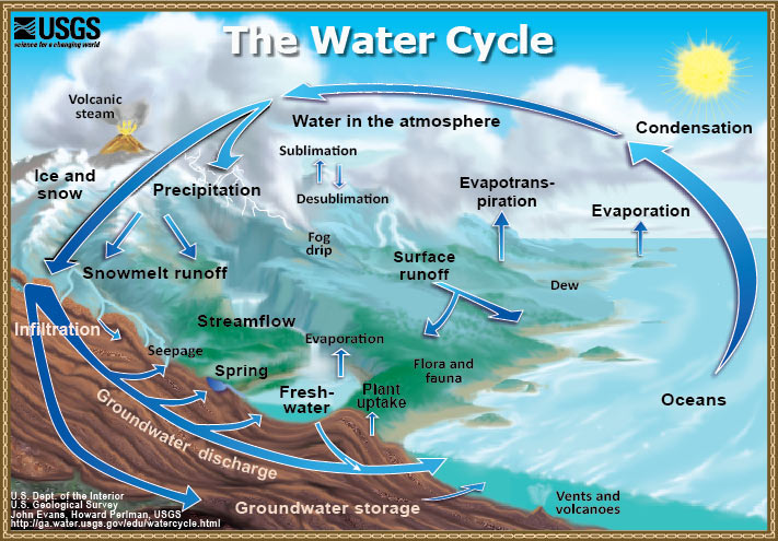
The two general categories of water are very interdependent of one another, and water typically moves from one category to the other though a process called the Hydrologic cycle, or water cycle illustrated below:
The interactions between elements of the hydrological cycle are incredibly complex, and far too extensive to cover in this webpage, Below is a link to the USGS Hydrology education portal with a variety of resources for more information on basic Hydrology. |
Objective:Essentially the goal of our model is to see and predict the large scale interactions between these two major types of water (surface and ground water). There are a lot of variables involved but for our model the primary variables included are:
While all the variables are accounted for within the model, the most significant is diversions, as they are changing the location of very large quantities of water. |
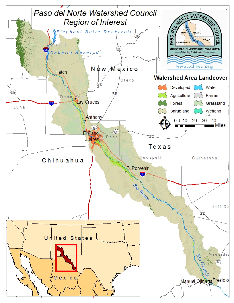
Our Location:Here is a map of the area we are concerned with. as you can see it streaches though southern New Mexico and along the Rio Grande river into the US-Mexico Border reigon. this area is called the Lower Rio Grande or LRG.
We mentioned above the added importance of this type of modeling in our area, Particularly in this LRG area because the climate becomes significantly more arid as the Rio Grande Moves south, and water management becomes more and more important. The upper Rio Grande is covered by a similar model developed in collaboration between the US Army Corps of Engineers, and several other agencies. For a more detailed summary of their operational model please visit their Website.
|
Modeling Tools:
|
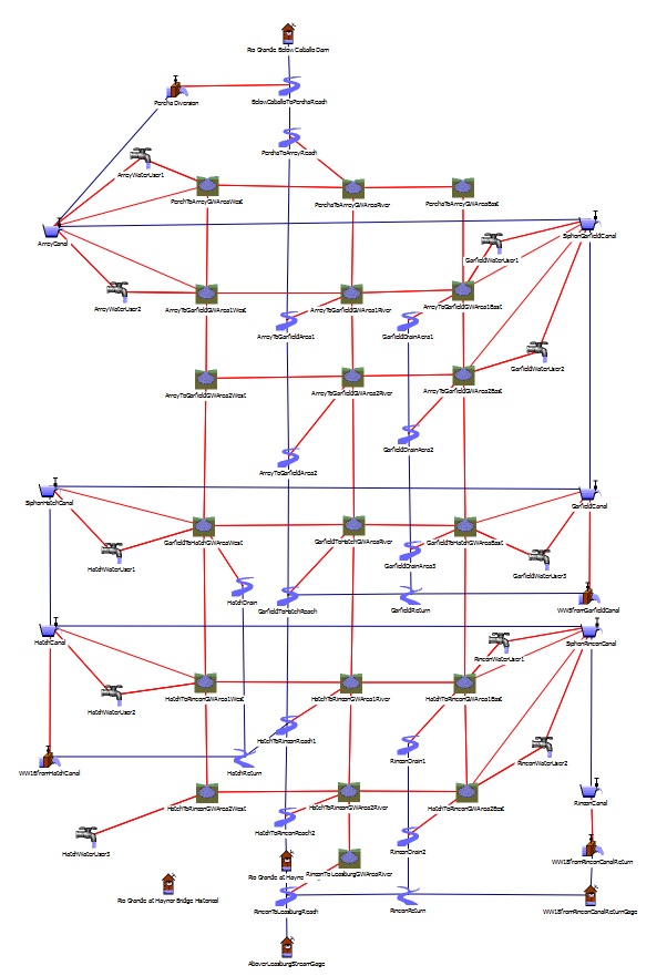
the modeling tool used in this project is called RiverWare. While RiverWare is a proprietary modeling program, A free viewer is availible from their website: Riverware Viewer Click on the "Requesting a Riverware License" link and follow the instructions to request the License. the Software is located in the "Download Files for Installing the RiverWare Viewer" link, the most recent version will do. Once RiverWare has received your license request they will prompty send you a License file. to use the viewer all you have to do is put the License file in the same file you have riverware installed (make sure its in the "top" folder). The email they send you with your attached license file will have detailed instructions on how to get started. now that you have RiverWare Installed and Licensed properly you can view our files availible for download here on our site. File interaction with the model using the free viewer is limited, it does provide a look into the methodology behind the model. Inside RiverWare, the model looks like this:
Each type of object has a different way it is calculated within the model, essentially its part of a larger equation, each with its own behavior. This site Links to the Riverware Documentation Page, to interpret the information in the viewer you will find the "objects" pdf most useful, however full documentation can be found on this same page. |
USACE Funded Hydrologic Modeling and GIS
|
As part of the PdNWC Coordinated Water Resources Database and GIS Project, project staff have worked with USACE scientists and other researchers to perform limited modeling of flood flows in the Rio Grande Project area. Previous to this modeling work, staff also conducted a limited review of the literature to explore previous hydrologic modeling that has been done within a GIS framework. Below you will find links to the general bibliographic research in this area and to a model output page that provided users the opportunity to select from a series of modeling scenarios and to obtain actual model output from the Riverware modeling software being employed in the URGWOM Project being conducted under USACE leadership. |