Our Watershed
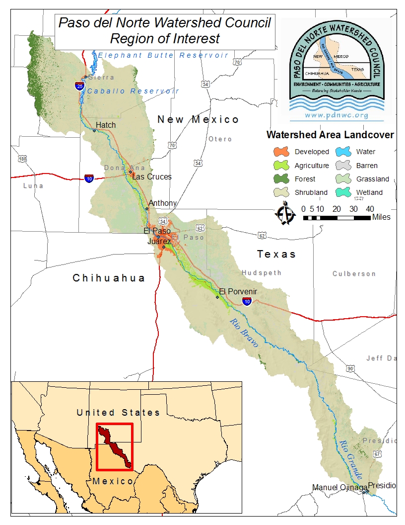
Many of the challenges associated with the management of the Paso del Norte watershed are due to its location along
the border of the United States and Mexico and in parts of the states of Texas, New Mexico, and Chihuahua. The watershed
extends approximately 340 miles along the Rio Grande/Río Bravo from Elephant Butte Reservoir in southern New Mexico to the
confluence of the Rio Conchas in Presidio County, Texas (includes approximately 430 river miles). With an average rainfall
of about 8 inches per year, the watershed receives its water from the Rio Grande and the Hueco, Mesilla, and Jornada aquifers.
It irrigates approximately 200,000 acres of farmland and is impacted by the needs of over 2 million people living primarily in
the cities of Las Cruces, New Mexico, El Paso, Texas, and Ciudad Juarez, Mexico.
Other challenges in managing the watershed are related to the 1916 damming of the Rio Grande at Elephant Butte Reservoir in
New Mexico to store spring 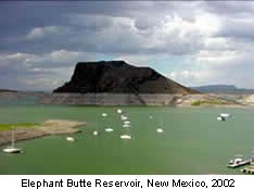 Elephant Butte Reservoir runoff for use in irrigated agriculture and provide flood protection.
This also altered river flows and essentially eliminated springtime flood pulses. Since that time, the Rio Grande has been
straightened and channelized to deliver water more efficiently to irrigators and for flood protection. The floodplain-now
contained between levees-is mowed annually for flood control. Releases of water from the upstream reservoirs only occur during
the growing season, roughly March to October. As a result, the winter flows in the river consist mainly of return flows from
agricultural drains and discharges from sewage treatment plants.The remaining aquatic habitat reflects the altered flows.
Elephant Butte Reservoir runoff for use in irrigated agriculture and provide flood protection.
This also altered river flows and essentially eliminated springtime flood pulses. Since that time, the Rio Grande has been
straightened and channelized to deliver water more efficiently to irrigators and for flood protection. The floodplain-now
contained between levees-is mowed annually for flood control. Releases of water from the upstream reservoirs only occur during
the growing season, roughly March to October. As a result, the winter flows in the river consist mainly of return flows from
agricultural drains and discharges from sewage treatment plants.The remaining aquatic habitat reflects the altered flows.
Binational watershed video
Mapping the Paso del Norte Watershed
The extent of the Paso del Norte watershed goes far beyond the banks of the
Rio Grande/Rio Bravo. It is a sub-region of the larger Rio Grande Basin,
extending from Elephant Butte Reservoir in New Mexico to the confluence of the Rio Conchas in Presidio County, Texas,
and includes all the land that drains into the Rio Grande between those two
points. Efforts to map the watershed (in addition to our
Interactive GIS Project) can be found at
the following sites:
New Mexico Water Resources Research Institude, New Mexico Watershed Maps
Paso del Norte Maps for Public Access
URGWOM (USACE)
USGS Activities in Texas
Texas General Land Office
Dams of the Rio Grande NM and TX (video)
More information on the Paso del Norte Watershed
Sources